
 IT
IT  FR
FR  DE
DE  EN
EN 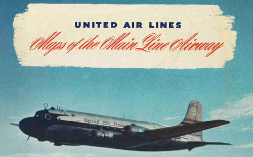
United Air Lines Maps of the Main Line Airway, published in 1946, is a route map booklet illustrating the principal air corridors served by United Air Lines in the immediate postwar period. The publication presents simplified maps of domestic routes, major stops, and connecting services across the airline’s network. Designed as an informational tool for passengers, it highlights the structure of commercial air travel at a time when scheduled aviation was expanding rapidly. As airline ephemera, the booklet documents how carriers communicated route geography and network identity in the mid-20th century.
| Precursori, Forerunners, Précurseurs |
|---|
|
|
| Viaggi stravaganti, Weird travels, Voyages insolites |
|---|
|
|
| Globetrotter contemporanei, Contemporary globetrotters, Globetrotteurs contemporains |
|---|
|
|
| Personaggi fittizi, Fictional character, Personnages de fiction |
|---|
|
|
Impressum
Copyright 2016-2026 Museum of Travel and Tourism (MTT)
Source citation "Museum of Travel and Tourism, museumoftravel.org"
Info Developed by www.rhpositive.net. Logo: icons www.flaticon.com. Translations Openai ChatGPT. Images Midjourney and ChatGPT, unless otherwise specified

